19 KATAMA FARM NORTH RD
Owner Information
CROTTY PAUL R & CHRISTINE V
1 FOUNDERS WAY
AMHERST, MA 03031


Property Details
19 KATAMA FARM NORTH RD is classified as a Single Family Residential (Colonial).
The primary structure on this property was built in 1987. There are 3,339ft2 of built area within this property. There is 2,488ft2 of residential/living space within this property.
19 KATAMA FARM NORTH RD is valued at $1,609,637. The land is valued at $919,937 and the structures are valued at $608,900. There is an additional valuation of $80,800 on this property.
This property is in Zone R60. Confirm with local Zoning Board authorities to ensure there are no overlays or other easements on this property.
The most recent deed for 19 KATAMA FARM NORTH RD is recorded at the local registrar in Book 1090, Page 0350. 19 KATAMA FARM NORTH RD was last sold on Friday, July 21, 2006 for $1,400,000.
Assessment data from fiscal year 2022.
Flood Data
According to the FEMA National Flood Hazard Layer, this property does not appear to be in a flood zone. It may also be in an area not yet reviewed. Nonetheless, confirm this information prior to taking any action.
To view the flood hazards around this property, create a FEMA "Firmette" Map of the area around 19 KATAMA FARM NORTH RD.
Broadband Internet Providers
| Provider | Type | Bandwidth (mbps) | |
|---|---|---|---|
| MVWIFI | Fixed Wireless | 20 | 20 |
| T-Mobile | Fixed Wireless | 25 | 3 |
| GCI Communication Corp. | Satellite | 0 | 0 |
| Viasat Inc | Satellite | 35 | 3 |
| HughesNet | Satellite | 25 | 3 |
| VSAT Systems, LLC. | Satellite | 2 | 1 |
| Verizon New England Inc. | DSL | 15 | 1 |
| Comcast | Cable | 1000 | 35 |
Broadband service provider data from December 2020.
Adjacent Properties
- 15 KATAMA FARM NORTH RD
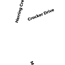
Developable Residential Land owned by BAUSS ROBT ET ALS - 38 CROCKER DR
Single Family Residential owned by NOEKER RAYMOND & PATRICIA - 40 CROCKER DR
Single Family Residential owned by LITCHISON LOUIS & SWEETSER KRISTA H--TRS - 42 CROCKER DR
Single Family Residential owned by FISHER MADELINE M - 21 KATAMA FARM NORTH RD
Single Family Residential owned by CONDLIN PAUL V & LINDALEE